Publish distributed raster data |
Feedback |
SuperMap iServer supports the direct publishing of
distributed raster data as a data source to a REST map services, where
raster data supports two storage types. They are local storage, HDFS,
Storage. You can create both distributed storage through the buildRasterPyramid
resource of the distributed analyst service.
You can publish existing map tiles as service by following
these steps:
- On the Home page of Service
Management -> Publish Service or the Services
-> Service Management page, click Quickly
Publish Service to enter the publishing wizard;
- Select "distributed raster data"
as the data source and click Next;
- Configuartion servicedata info, click Next:
- Select storage type
and fill in the storage information in turn:
- For storage type, select "local
storage": fill in "local directory", for example,
F: \ test \ catalog;
- For storage type, select "geotrellishdfs":
fill in "service address", that is, HDFS service
address, in the format of hdfs://{ IP }: { port }/test;
- Sets whether Kerberos authentication is turned on. If the HDFS
cluster is in Kerberos authentication enabled mode, check Enabled Kerberos Authentication,
and fill in the following information:
- Hadoop cluster core-site.xml file path: The path of config
file of Hadoop cluster core-site.xml in the iServer host.
- HDFS cluster hdfs-site.xml file path: Fill in the path
of config file of hdfs cluster-site.xml in iServer host
- Kerberos client config file path: Fill in the path of config
file of Kerberos client krb5.ini in iServer host
- Kerberos principal name: fill in the Kerberos principal
name;
- Kerberos principal keytable path: fill in the Kerberos
principal keytable path;
- JAAS config file path: fill in the jaas.conf config file
path;
- Select the published service type, such
as rest map service and rest data service, and click Next;
- Configure the corresponding service according
to the selected service type, and click Publish;
- If you select to publish map services, such as rest map service,
WMS1.0.0 service, and wmts 1.0.0 service, you need to enter or
click the Select button to select .style file in JSON format,
used to specify the style of the map;
- If you select to publish data services, such as rest data service,
wfs1.0.0 service, and ArcGIS rest feature service, you need to
set whether the data services are editable. The default is not
editable.
- After publishing, you can see the name
and link of the currently published service. Click it to access the
service directly.
Note:
When you use the old version, if the UI performs service publishing
and the raster data has been subjected to data registration, you can specify
the style for the map and customize the map status. The specific configuration
is as follows. After configuration, continue to click Next.
- Map name: to set the name of the desired published
map name.
- Whether to open multiple versions
- Default: Multiple versions are not enabled.
- Layer ID: ID of the layer to be published
- Check to open multiple versions
- Select Add Version or Remove Version to add
or remove a defined version.
- Version name: The name of the version that
publishes the customizable map services.
- Layer ID: the layer ID to be published corresponding
to each version can be selected
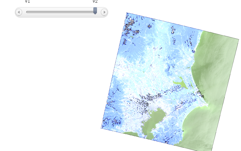
- When publishing services, if you select Customize Map Status
to enable multiple versions of a map, you can select the version
to browse the map, as shown in the following figure:


